Natural Attractions of Ethiopia
Experience the natural beauty
Ethiopia offers exceptional natural features and a rich bio-diversity ranging from deep gorges, wide valleys, volcanic lakes, savannahs, and semitropical forests, to the low lands of the Omo Valley and the Danakil Depression (Dallol), one of the earth’s hottest places.
Simien Mountains
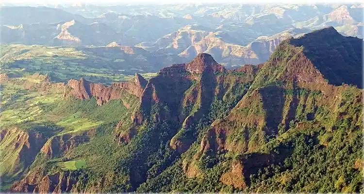 The Simien Mountains National Park is a UNESCO World Heritage Site situated in Northen Ethiopia near Debark where the park Head Quarters are located. The park was made a world heritage site in 1978.
The park holds the highest mountain in Ethiopia; Ras Dashen which stands at 4535m. The high altitude of the ridge means the climate is quite cool allowing a number of species to live which are found no where else on earth. Some of these species include the Walia Ibex Ethiopian Wolf and gelada baboon.
Omo National Park and River
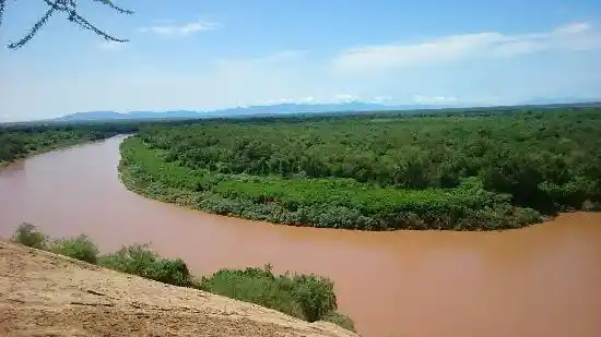 Omo National Park is on the west bank of the Omo River in the lower Omo valley. The park is 140 km long, stretching from the Neruze River in the south to the Sharum plain in the north, and up to 60 km wide where the Park Headquarters are situated. There are three hot springs, and the park is crossed by a number of rivers, all of which drain into the Omo. The park is home to the Surma, Mogudge and Dizi peoples, with the Bume (yanyatong) making much use of areas in the south and the Mursi crossing the Omo River from the east. These people are pastoralists and hunter-gatherers, but also cultivate a few crops on the river levees, and make extensive use of the river resources.
Lake Tana
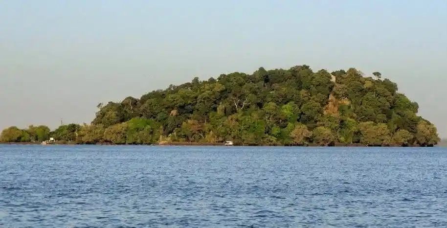 Lake Tana is the largest lake in Ethiopia and the second largest in Africa. Lake Tana covers an area of 3,000 square kilometers, while its catchment area covers 15,000 square kilometers. Four major rivers feed into the lake, including Gilgel Abbay, which flows from the south, Gumera and Rib from the northeast and Megech from the north. The Tana basin connects about two million people, the majority of whom subsist on agriculture, while the two largest cities in the Amhara region, Bahir Dar and Gondar, lie within the basin.
Blue Nile Falls
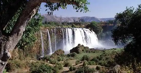 The Blue Nile Falls are located in the Ethiopian plateau, passing the Blue Nile River. It is one of the greatest falls in Africa. The Blue Nile River is a tributary of the Nile River which is the world’s longest river. It originates at Lake Tana. The waterfall is located on the upper course of the river. To reach the falls, which is about 35 kilometers (22 miles) away from Bahir Dar, drive south from Bahir Dar for about half an hour, and stop at Tis-Isat village. A rewarding but longer trek is to walk along the east bank all the way to the back of the falls; crossing the river by tankwa.
Entoto Hill
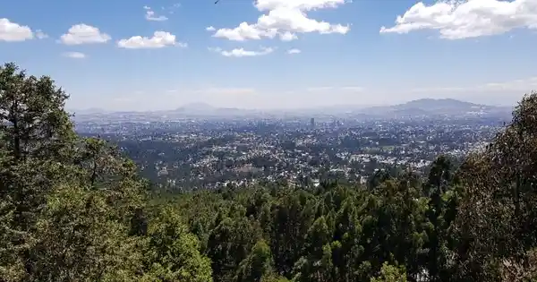 Mount Entoto is the best spot to enjoy the great scenery of Addis Ababa. Mount Entoto is also where two of the oldest Ethiopian Orthodox Christians Churches are found at – St. Raguel (Elias) and St. Mary of Entoto. It reaches 3,200 metres above sea level and is part of the Entoto mountain chain. It is a historical place where Emperor Menelik II resided and built his palace, when he came from Ankober and founded Addis Ababa 125 years ago. It is considered a sacred mountain and has many monasteries, it is also the location of a number of celebrated churches, including Saint Raguel and Saint Mary (Entoto Mariam).
Danakil Depression
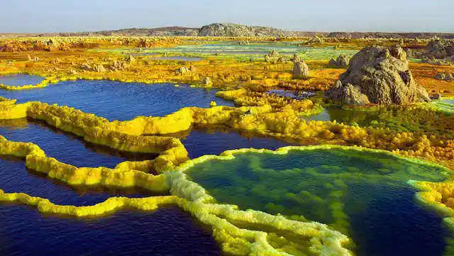 The Danakil Depression is located in the Afar region in northeastern Ethiopia, close to the border of Eritrea and Djibouti. It’s considered one of the hottest (average 34,4 C), driest (100-200 mm rainfall/year) and lowest regions on earth (125 meter below sea level). It is also one of the most geologically active regions with three tectonic plates meeting at the Afar Triple Junction. When tectonic plates move apart like at Danakil, it creates lave lakes, hot springs, geysers and fissures in the ground. Here the toxic gases saturate the air, the pH is extremely acidic and saline and metal concentrations are very high.
Bale Mountain
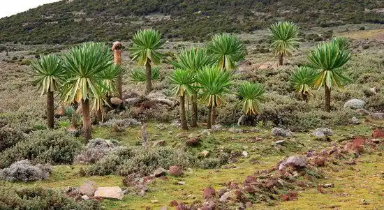 It is located 400 km south east of Addis Ababa. Bale Mountains National Park contains a spectacular diverse landscape, the high altitude, Afro-Montana plateau rises to over 4000 m and includes the highest peaks in the southern Ethiopia highlands. This undulating plateau is marked by numerous glacial lakes and swamps and surrounded by higher volcanic ridges and peaks. The southern slopes are covered by the lush and largely UN explored Harenna forest. This national park has a beautiful landscape, natural forests and great wild life. It is a good place for hikers, wildlife watchers, culture and nature enthusiasts, and bird watchers, horseback and go fishing.
Gheralta Rock
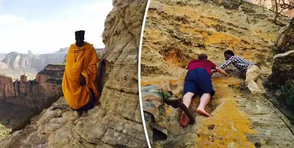 Gheralta is a dry plain with steep outcrops of cliffs and table mountains with very dramatic landscapes. But for most tourists to Ethiopia, the main reason to come to the Gheralta region is for its about 35 churches, the largest concentration of cliff churches of Ethiopia. While Lalibella may be the place with the highest density of rockhewn churches, the Tigray region has plenty more, most of them being much older, with more paintings, special architecture at remote locations. Maybe not the oldest, but the rock hewn churches om Gheralta often have the most colorful paintings and church treasures.
Erta Ale
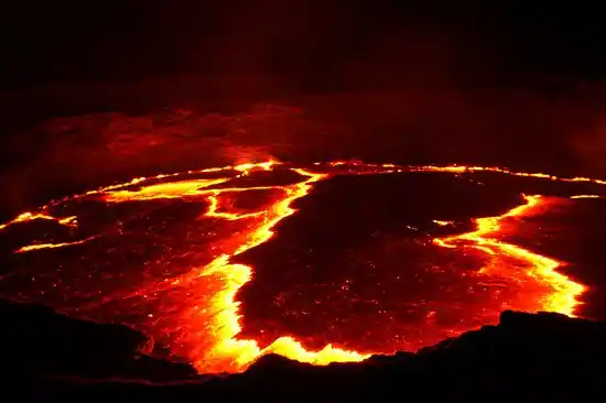 Erta Ale volcano is a large basaltic shield volcano in the Erta Ale volcanic range in the central northern Danakil depression (NE Ethiopia).
It is famed for its persistent lava lake which has been active during most of the past decades since it was first discovered in the 1960s.
Erta Ale is only 613 m high, but as typical for a shield volcano has a very gentle slopes and a large 40 km diameter base. The summit is truncated by a complex, elongated 1700 x 600 m wide caldera which contains vast lava flows and several larger and smaller pit craters, most notably the active north and south crater, which contains the lava lake at present. Erta Ale is one of the main attractions of the Danakil, and had became a popular tour destination in recent years.
Sof Omar Cave
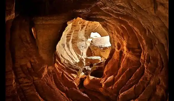 Sof Omar Cave is one of the world’s most spectacular and extensive underground caverns. Sof Omar is an extraordinary natural phenomenon of breathtaking beauty. At 15.1 kilometres long, Sof Omar Cave is the longest cave in Ethiopia and the largest system of caves in Africa, through which the Weib River flows. It is said that Allah revealed the opening to this limestone cave system to Sheikh Sof Omar in the 12th century. The sheikh and his followers used the caves as a mosque, a purpose to which the caves were well suited as they had been eroded into columns, buttresses, domes, vaults, and pillars – a natural architectural marvel still used as a gathering place by local Muslims.
Mago National Park
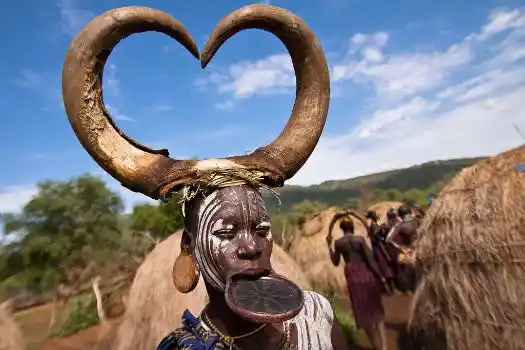 Mago National Park is one of the National Parks of Ethiopia. Located in the Southern Nations, Nationalities, and Peoples’ Region about 782 kilometers south of Addis Ababa and north of a large 90° bend in the Omo River, the 2162 square kilometers of this park are divided by the Mago River, a tributary of the Omo, into two parts. To the west is the Tama Wildlife Reserve, with the Tama river defining the boundary between the two. To the south is the Murle Controlled Hunting Area, distinguished by Lake Dipa which stretches along the left side of the lower Omo. In the dramatically beautiful 2162-sq-km Mago National Park, wildlife is fairly abundant by Ethiopian standards, and the Mursi Tribe lives on the eastern shore of the Omo River

BETE URAIEL CHURCH LALIBELA

ARTHUR RIMBAUD HOUSE MUSEUM, HARAR

ATATAMI KIDUS MIKAEL CHURCH

BET ABBA LIBANOS CHURCH, LALIBELA

BETE GABRIEL AND RUFAEL CHURCH

BETE MEDHANE ALEM CHURCH

CHAPEL OF THE TABLET

BETE MARYAM CHURCH LALIBELA

EMIR NUR TOMB

ETHNOLOGICAL MUSEUM ADDIS ABABA

FASILADAS BATH TIMKET GONDAR

GEBRE MESKEL TOMBS

NATIONAL MUSEUM ADDIS ABABA

OUR LADY MARY OF ZION CHURCH

QUEEN SHEBA PALACE AXUM

SAINT GEORGES CATHEDRAL ADDIS ABABA
Fully Customized Tour Packages
We prepare and organize custom itineraries based on your preferences.